Discover the Camí de Ronda hike, with over 10 of the most beautiful Costa Brava coves in less than 4km!
La Costa Brava is famous for being one of the most beautiful coastlines in the Mediterranean Sea, if not worldwide. Its unspoiled rocky coast, paradisiac beaches, coves, and turquoise clean waters attract millions of visitors every year. Some of these beaches and coves are easily accessible. However, the most beautiful ones are usually not as easy to access, with small parking lots that are not exactly by the beach. Even in specific cases, there are beaches only accessible from the sea, either by kayak, boat, or swimming.
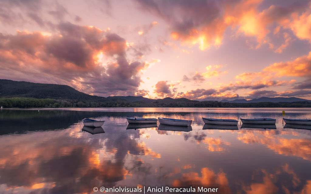
Discover the BEST Costa Brava Sunrise spots!
Some of them are included in this guide! Check them here!
Yet, there is a way to discover some of the best Costa Brava coves, the old Camí de Ronda hike. More than 10 coves in just 1-hour of hiking! Free, amazing scenery and crystalline waters. What else do you need? This article covers all you need to know, from what is el Camí de Ronda, technical details, the route, and what to see on the hike.
What is el Camí de Ronda?
One of the best ways to discover and explore the best coves of la Costa Brava is hiking. Fortunately, la Costa Brava is well prepared and has the so-called Camí de Ronda. This 43km route connects Sant Feliu de Guíxols with Begur and has some of the best views of the famous Catalan coastline. The path follows the sea, and due to the wilderness of the coast, it has some steep sections, although almost everyone, given a proper physical condition can enjoy it.
Despite it is possible to do the whole route in 2-3 days, it is more common to do sections of it. Among the most important ones, there is the Sagaró to Platja d’Aro section or the Palam´ós to Calella de Palafrugell. However, in this article, you will find the details of my favorite section, the one connecting Palamós with Platja d’Aro. What makes this hike special is the number of coves. Unlike in other sections, this hike will bring you to over 10 coves and beaches, some among the most beautiful of la Costa Brava.
Difficulty, gear, and indications
The section of Camí de Ronda between Palamós and Platja d’Aro is a wild one. During the route, you will cross many beaches and coves, crowded in summer and deserted in winter. However, one does not need anything special to walk it.
Yet, the path is a dusty one, with lots of stairs and some slippy sections, so it is highly recommended to wear adequate shoes. Although many people wear flip-flops (or even go barefoot), sporty shoes will do the trick. Make sure to bring your flip-flops though, especially if you are doing it in the summer months. You will end up sunbathing in any of the coves, and they will come in handy.
As part of one of the most famous hikes of la Costa Brava, it is very easy to follow the route. The path of el Camí de Ronda can be identified at first sight, as it is usually signaled with red and white paint. There are even some informative panels detailing which cove you are in and the distance from the nearby villages, Calonge and Platja d’Aro.
When to hike el Camí de Ronda
El Camí de Ronda can be hiked at any time of the year. Nonetheless, depending on the season, the attractions of the route will change.
During the warm summer months (June to September), the Camí de Ronda is a perfect one-day trip to enjoy la Costa Brava at its fullest. Bring some food, your swimsuit, and spend the day sunbathing in any of the coves you find on the hike. From Cala Cap Roig to Cala Sa Cova (see below), each of them has its own attractiveness. Note that coves will be full of tourists and locals, especially in the high season months, July and August.
Outside the warm season, during spring, autumn, and winter, the hordes of tourists disappear or at least are less frequent. The water temperature drops but the views are way better. Fewer people, quiet beaches, and silence. You can still encounter many locals, either running or hiking. Of course, swimming and sunbathing might not be the highlights of the day, but the views will be. Consult the weather forecast, and don’t hike if there is any chance of a sea gale. The path is too close to the sea and there have been unfortunate accidents.
The route: Costa Brava coves hike
This section of el Camí de Ronda starts (or ends) in Palamós or Platja d’Aro. These two seaside cities are separated by less than 6km and the rocky section between them is the one featured in this article. It is possible to start from any of the two cities, as the route can be followed in any direction. One way, the route is around 7km.
However, there is another option. From Palamós to the actual start of the hike section, there is a 3km walk, surrounding the seaside to the village of Calonge, where the route actually starts. Thus you could skip these 3 initial km and start your hike from Calonge (the exact spot is Torre Valentina, see below). Similarly, it is possible to skip the “ugly part” of the route in the Platja d’Aro side and start from Cala Rovira.
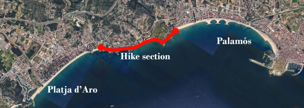
If you want to park your car at any of the ends of the route, it is likely that you will start from either Palamós or Platja d’Aro. Yet, you can skip the non-hiking part at any of the two ends of the route.
Thus, the section of the route explained in his article covers Torre Valentina (Palamós side) to Cala Rovira (Platja d’Aro side). This is where all the coves are located, and it is, without any doubt, the most beautiful section of el Camí de Ronda. Remember that it can be done in any direction. The total length of this section is 3km one way.
Starting point: Torre Valentina (Palamós)
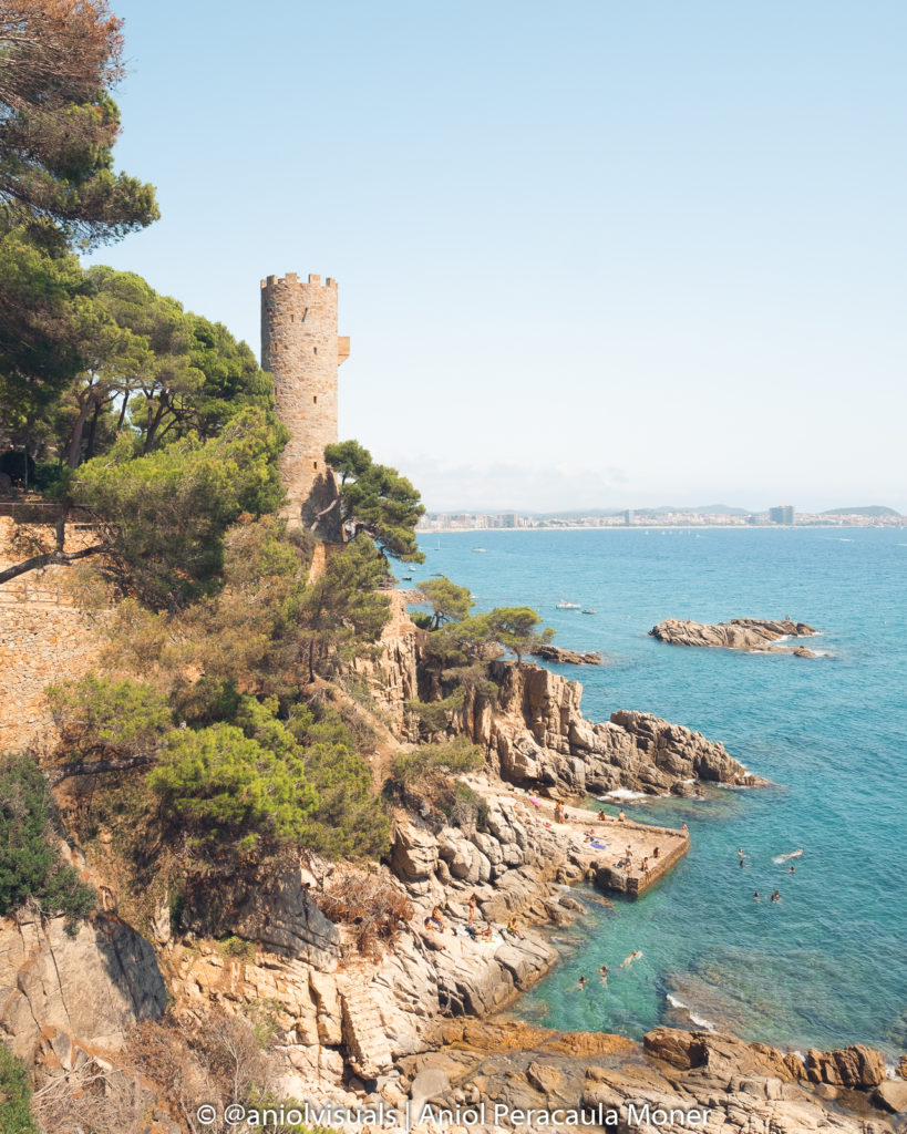
The starting point of the hike that will lead to some of the best coves of la Costa Brava is Torre Valentina. This old coastal defense tower dates back to the 15th century and was built to protect the village of Calonge from the Pirate attacks, quite common in la Costa Brava. As a fun fact, it did not have a door or inner stairs. It was only accessible using a ladder. It stands out for being surrounded by more modern buildings.
Just in front of Torre Valentina, there is its magnificent beach and the path that will bring us along the coast towards Platja d’Aro (Cala Rovira).
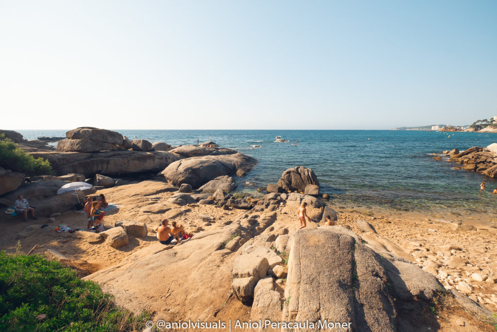
Racó dels Homes Cove
The first cove in our hike is at a mere 1-minute walking distance from the starting point. After passing by what looks like (and is) a couple of old bunkers, there is the first cove. The path goes to the right, but in front of us, there is the Racó dels Homes Cove. Its original name in Catalan can be translated as Men’s Corner, and it is a small rocky beach, perfect for a quick dip at the beginning (or end) of the hike.
Roca dels Musclos Cove and Torre Colomina
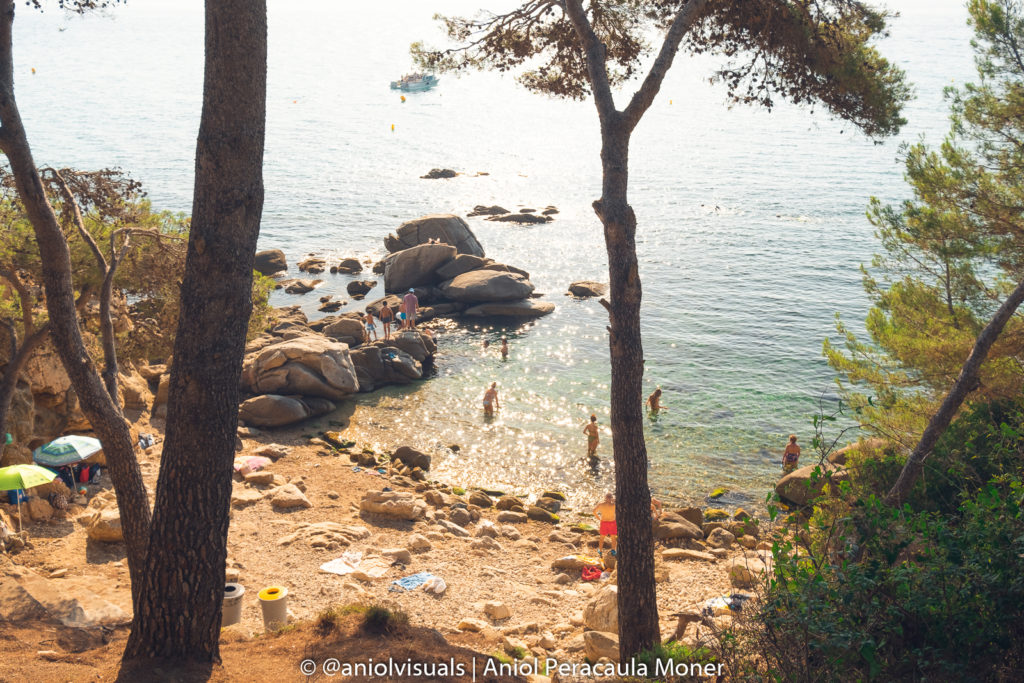
After a few meters, one of the first wild coves appears, the Roca dels Musclos. Its name can be translated as Mussels Rock, which indicates what it was used for not that long ago. Nowadays it is one of the least accessible coves of the hike. This makes it very quiet, something that is very appreciated especially during the summer months.
At first sight, one might miss the Roca dels Musclos Cove, and it is because of Torre Colomina. The second (and last) of the towers of this hike is higher than Torre Valentina and melts perfectly with the surroundings.
Roques Planes Cove
The path follows one of the most authentic and well-preserved areas of la Costa Brava and brings us to the third cove. The Roques Planes cove takes the name of the curious shape of its rocks. Roques Planes means Flat Rocks in Catalan. Due to erosion, the rocks of this cove have a very characteristic flat and long shape, perfect for sunbathing.
Roca de Paller Cove
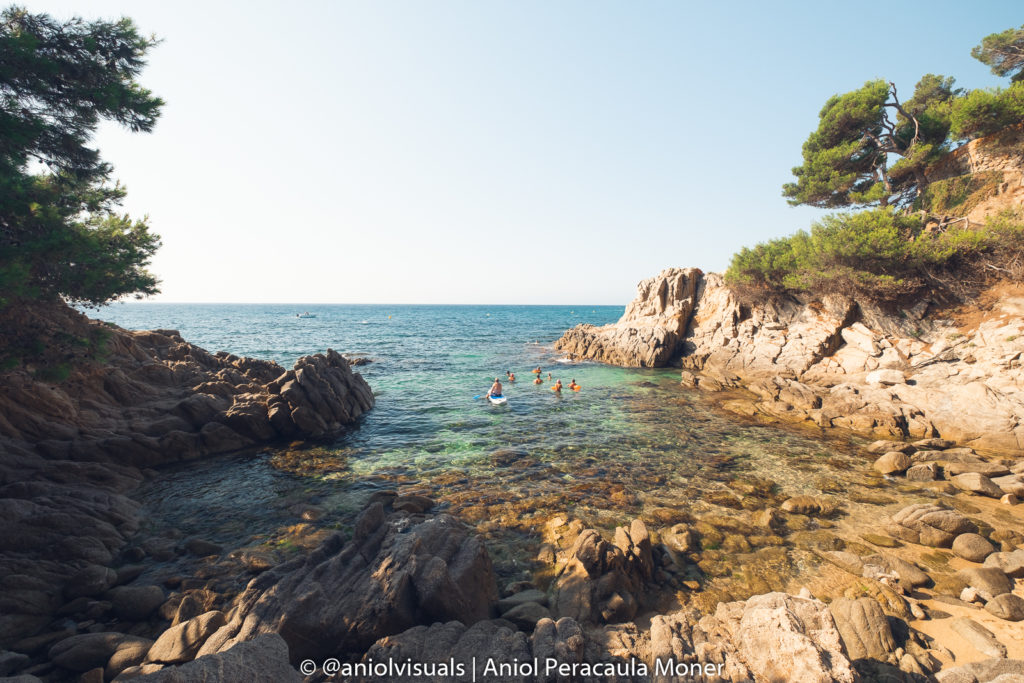
Immediately after the Roques Planes Cove, we find the first cove that needs to be crossed on foot. No matter how hard you try, you will get your shoes full of sand. The Roca de Paller Cove, also known as Paller Cove is a cute small cove with a curious rock at its center. It is this rock, that looks like a haystack that gives name to the beach. As you can guess, Paller in Catalan means haystack. The Camí de Ronda path continues at the opposite side of the cove.
Esculls Cove
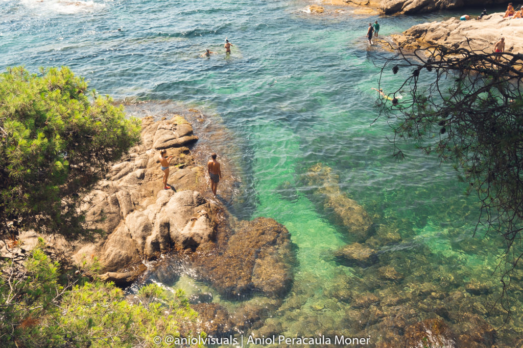
The third cove of the first “coves section” is the Esculls Cove. After the wild Roca dels Musclos Cove and the surprising Roca de Paller cove, there is Esculls Cove. This tiny cove has almost no sand, but many rocks. In fact, Escull means stumbling rock. It is easy to understand why it got its name, as it has lots of them. Getting into the sea can be challenging from this cove. If you are looking for an easy and accessible cove, keep walking!
Can Cristus, Torretes and Cala Gogó
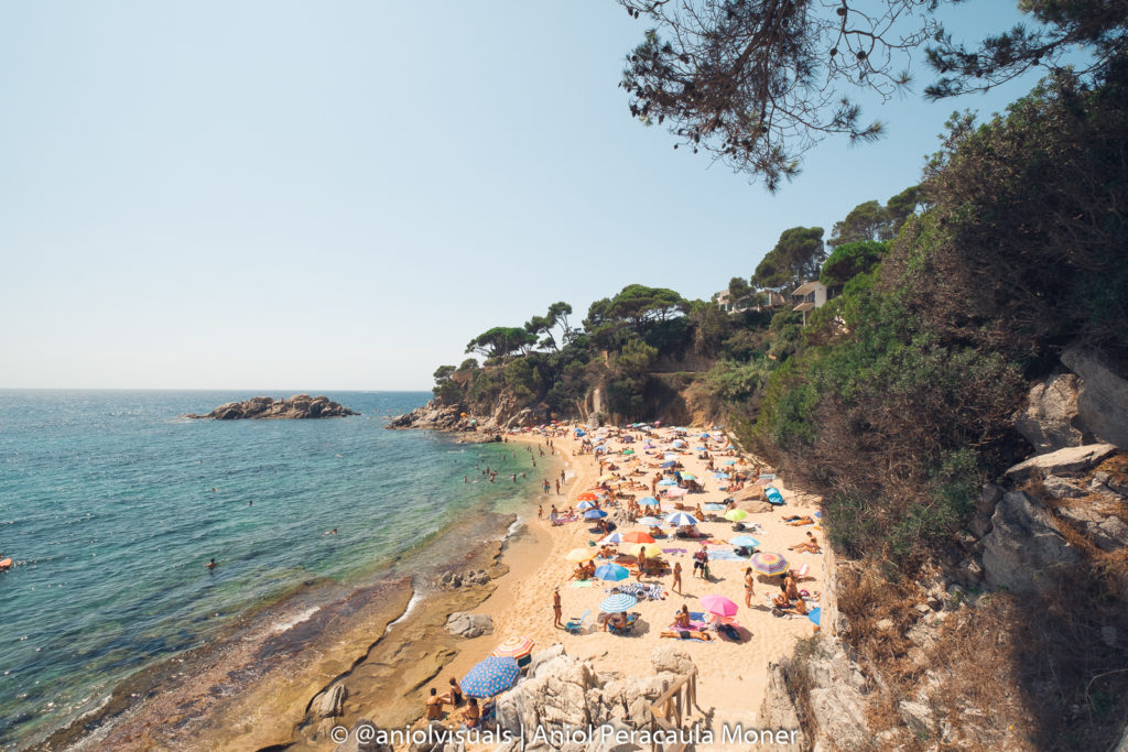
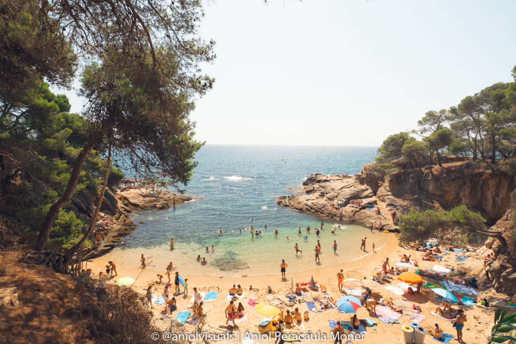
After a set of beautiful cute coves, the landscape suddenly changes, with three beaches/coves that are nothing like their nearby sisters. One next to the other, and crossed on foot, Can Cristus, Torretes, and Cala Gogó, are the most crowded area of the hike, especially during summer (together with Cala Cap Roig). Being more accessible and with camping just next to it, these three coves are full of people in summer but very enjoyable during winter.
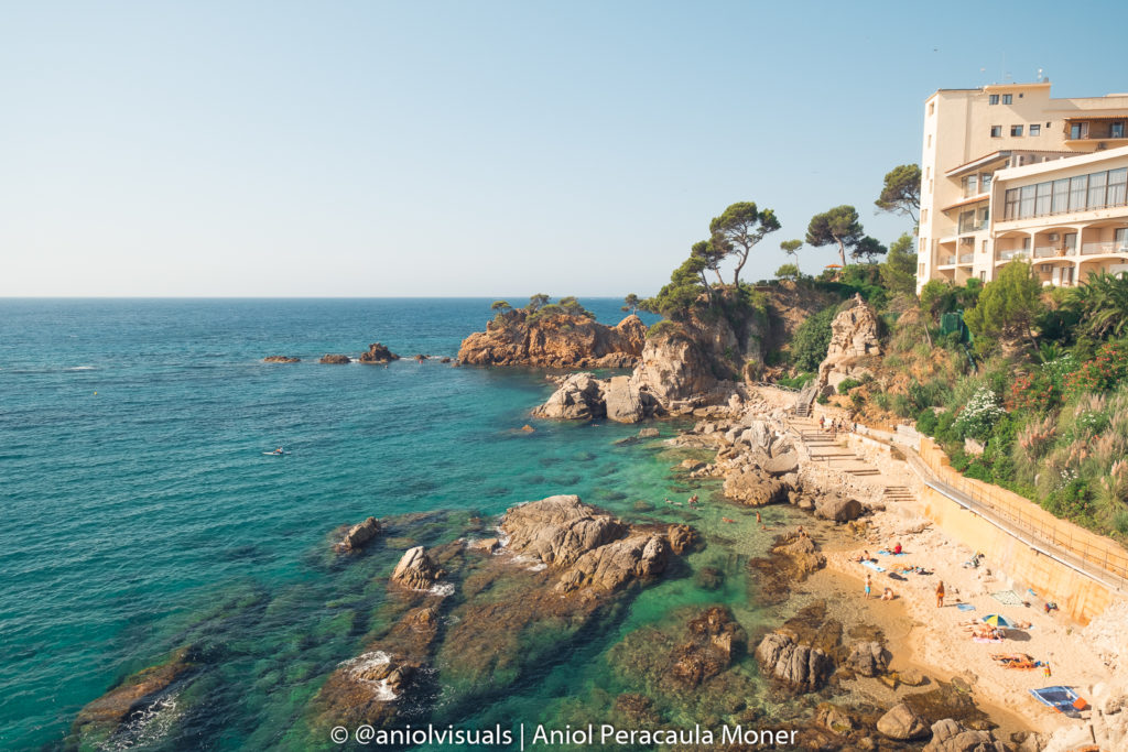
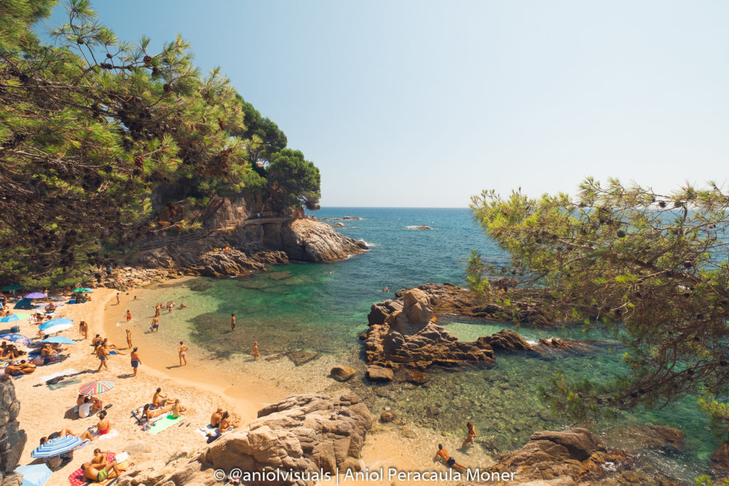
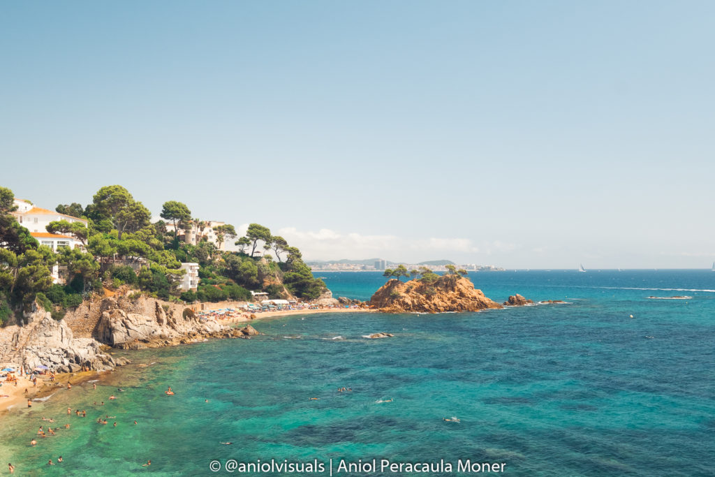
Cap Roig Cove
After the three contiguous beaches, we reach one of the most beautiful coves of la costa brava, Cala Cap Roig. The path that leads to it, has some breathtaking views, only disturbed by the ugly apartment blocks.
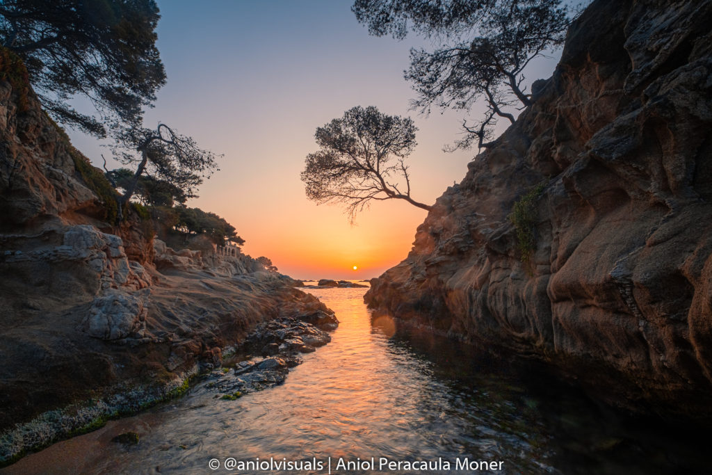
Sunrise photography at Cala Cap Roig
Capture one of the best sunrises of la Costa Brava. Find out how here
Cap Roig Cove gets its name from the reddish rock that divides the cove in two. Roig in Catalan means red, and it really lives up to the expectations. Especially without any people at sunrise, Cap Roig is among the best sunrise spots in la Costa Brava. Unfortunately, during the summer months, after 10 am it is almost impossible to cross it. However, to continue the hike, we need to do it, as at its end there is the path that leads to Belladona Beach.
Belladona Beach
With the enormous Cap Roig rock on the horizon, we enter Belladona Beach. Although compared with the nearby coves it is nothing special, it is good swimming and snorkeling spot.
Paller or Canyes Cove
Although in Google Maps it appears as the Paller Cove, I have always known this beautiful cave as the Canyes cove. Depending on the moment of the year it is very easy to understand its name. Canyes means canes in Catalan, and it is the main vegetation of this cove. It is also one of the nudist coves of the hike. After the view of the Canyes Cove, the final meters of the hike begins, with two amazing small coves.
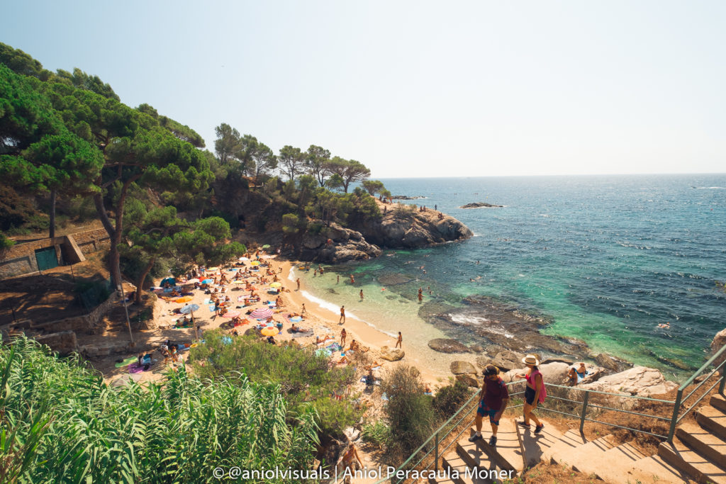
Pi Cove
Pi in Catalan means Pine. By looking at any image of the Cove, it is quite obvious why it is the Pi Cove. This cove is one of the most beautiful of the route, but its proximity to the end makes it also one of the most crowded during the summer months. Nonetheless, on non-tourist hours (or seasons), it is a true hidden gem of the Costa Brava.
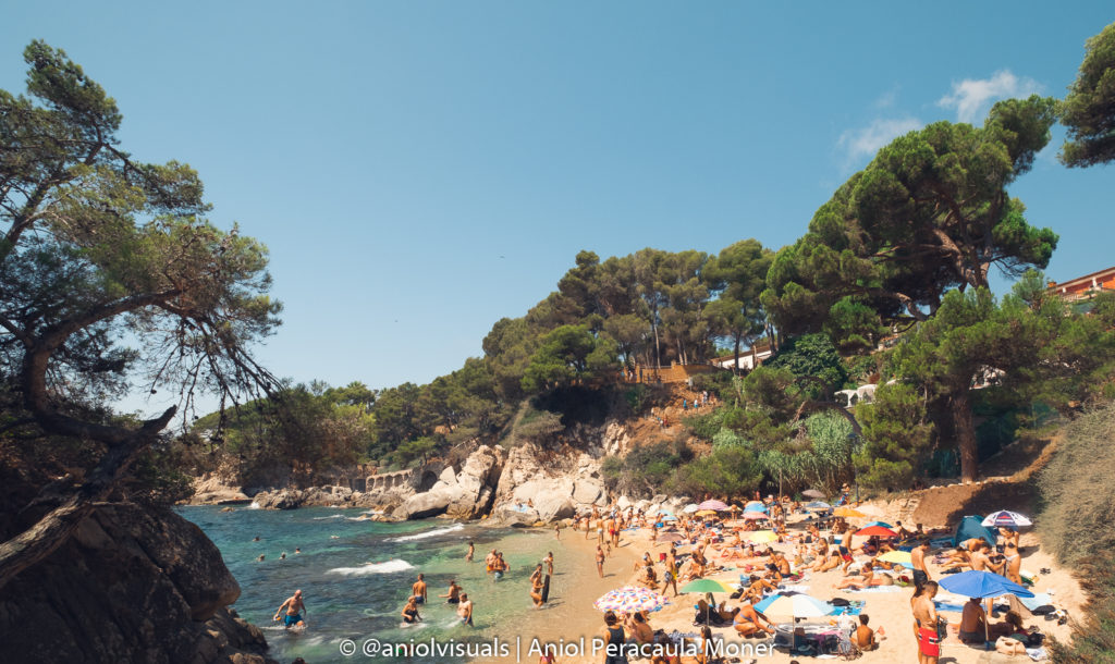
Sa Cova Cove
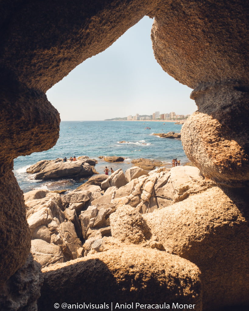
Before reaching Cala Rovira (Rovira Cove) and the end of the hike, there is one final treasure. Sa Cova is my favorite cove of la Costa Brava, not for its beauty (although it is gorgeous) but for its location. Just next to Platja d’Aro, but still quiet and silent in winter, when I enjoy the most this hike. Of course, during the high season, it is full of people that enjoy its crystalline water.
The tunnel excavated in the rock that reveals the view of the cove is a fantastic photography spot, perfect for a different Instagram shot.
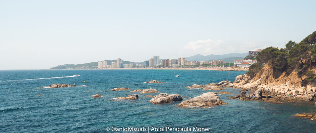
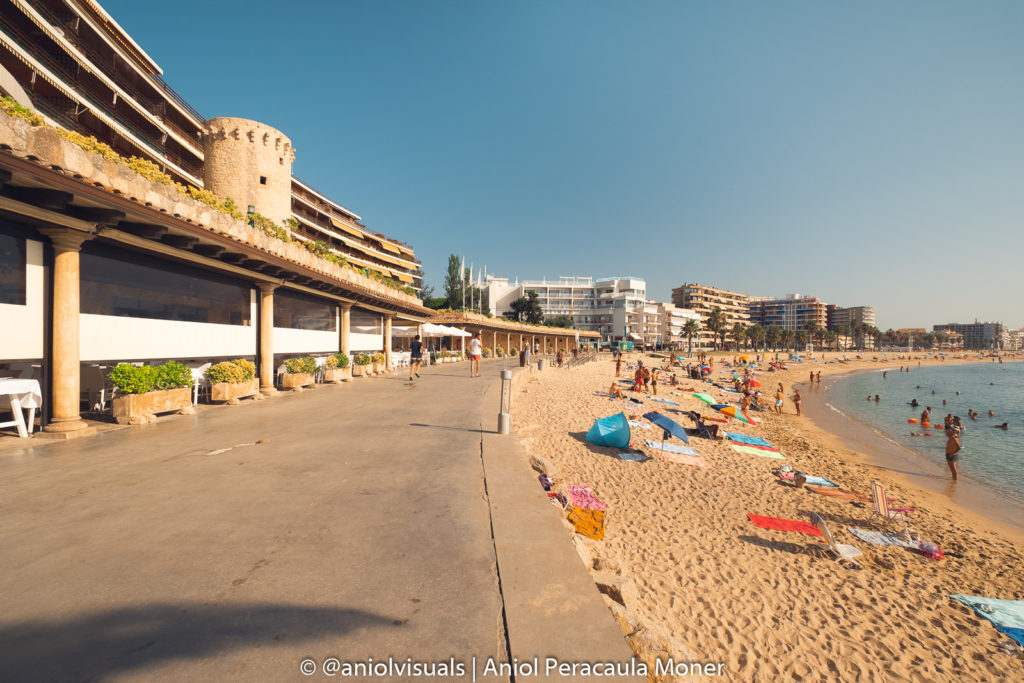
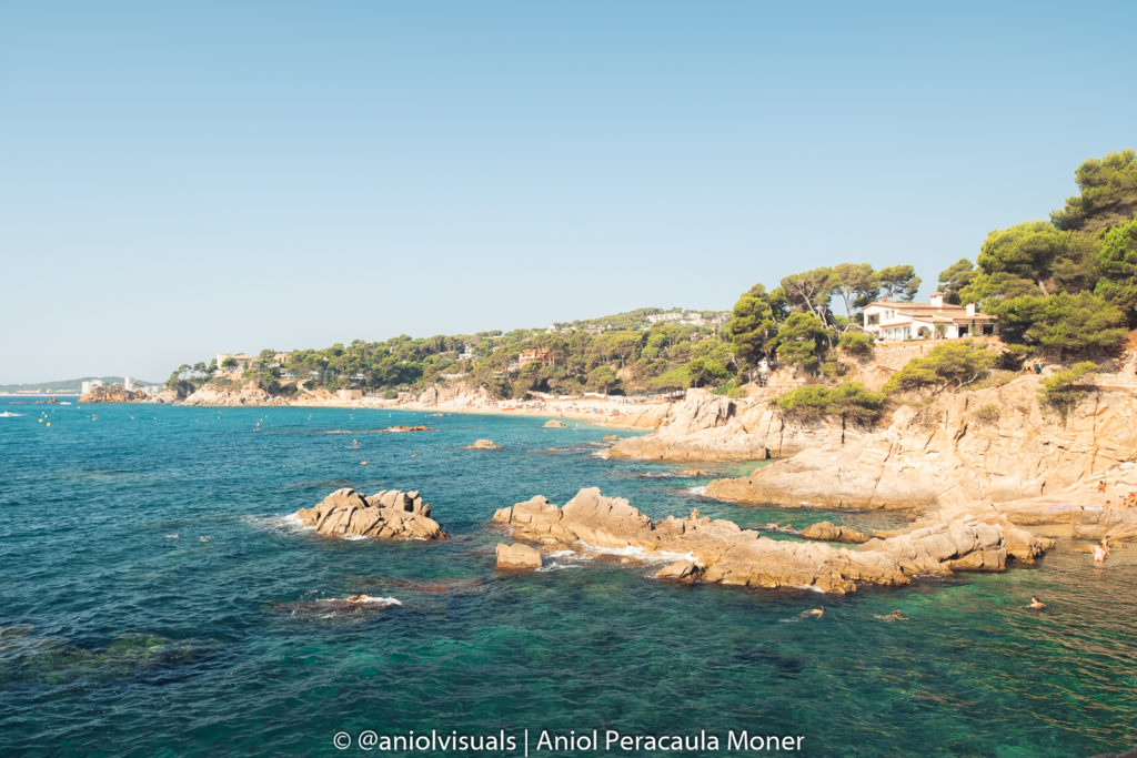
Finish point: Rovira Cove
The Costa Brava coves hike ends at Rovira Cove. Just next to the enormous Platja d’Aro beach there is this large cove, with apartments, easy access, and lots of people. Notice the small section of the cove that is oriented towards Sa Cova. It is one of the best sunrise spots of la Costa Brava.
After reaching Cala Rovira, the route goes back the way it came. However, the views from the return route will surprise anyone. despite being the same route, there are unnoticed details everywhere. Unlike other hikes, where the return route can be boring, this one is surprisingly interesting.
This has been the guide of costa Brava Coves’ hike from Palamós to Platja d’Aro, starting at Torre Valentina and finishing at Cala Rovira. Get more Costa Brava and Catalonia inspiration below! Follow me on Instagram (@aniolvisuals) for more travel-related content. Drop any questions at the comments section below and I will answer them as soon as possible. For any other inquiries feel free to reach me at hello@aniolvisuals.com.

Best things to do during Girona festivities (Fires Sant Narcís)
Girona Temps de Flors: a complete guide with local tips
Best hikes in la Vall de Núria: from beginner to expert
Best outdoor day trips from Girona [with local tips]
How to climb la Pica d’Estats: hiking the Catalan Pyrenees
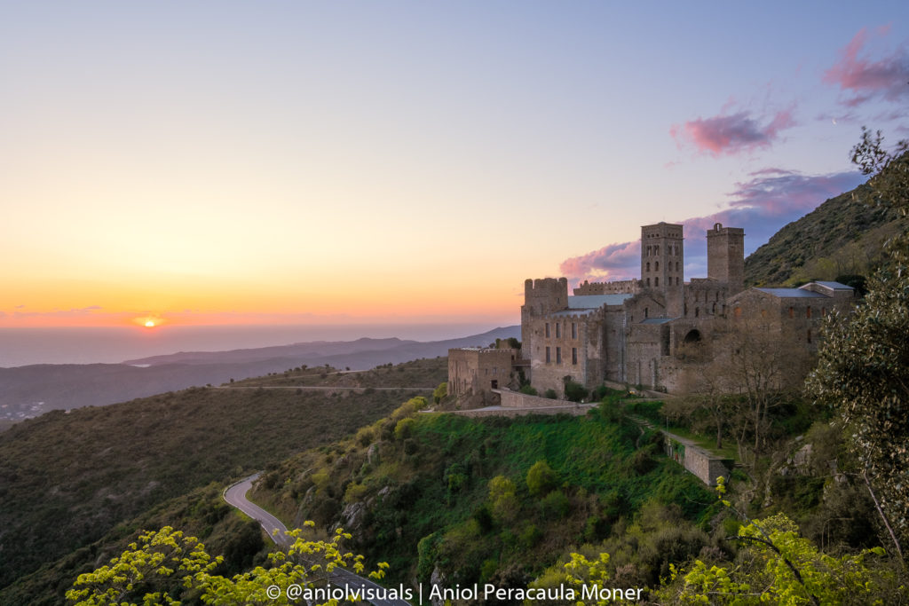
What to do and see in Sant Pere de Rodes
What to do and see in Besalú: a complete travel guide [photography spots]