Hike to the top of the Catalan Pyrenees. Find out how to climb to the top of la Pica d’Estats, what to pack, and more!
La Pica d’Estats is probably the most iconic mountain of Catalunya, the second one if you count Montserrat. The reasons for its popularity are many. First and foremost, la Pica d’Estats is the highest mountain of Catalunya. Its 3.143mts (10.300ft) make it not only the sky of the Catalan Pyrenees but also the 38th highest peak of the whole Pyrenees. Moreover, la Pica d’Estats is located in the Alt Pirineu Natural Park, one of the most beautiful areas of Catalonia. Finally, it is also a quite easy mountain to climb, provided a good physical condition and preparation. Thus, it is a usual hike among mountain lovers.
FUN FACT: The peak of the mountain is located in 3 different countries, Spain, France and Andorra, thus, its name. Pica means Peak, and Estats means States/Countries, indicating the peak of different states/countries.
- La Pica d'Estats FAQs
- When is the best season to climb la Pica d'Estats?
- How to get to the hike starting point? (La Molinassa parking)
- How long does it take to climb la Pica d'Estats?
- What to pack for la Pica d'Estats?
- Can I camp wherever I want in la Pica d'Estats?
- Can I swim in the lake d'Estats?
- Can I drink the water I find?
- Will I have phone service?
- The route
If you are reading this it is likely that you are considering climbing la Pica d’Estats. Congrats! It is a truly unique experience, and I hope you find useful information here. Otherwise, feel free to leave a comment with your questions below or get in touch with me through Instagram (@aniolvisuals).
Before talking about the exact route, and getting more technical, let’s tackle some of the most important FAQs related to climbing la Pica d’Estats.
Looking for other adventures in the Pyrenees? Discover Vall de Núria!
A complete guide to a unique valley in the Girona Pyrenees! Check it here!
La Pica d’Estats FAQs
When is the best season to climb la Pica d’Estats?
Generally speaking, August and September are the best months to climb la Pica d’Estats. It is during these months that there is the lowest probability of finding snow on the mountains, thus simplifying the route. However, the photos that appear in this article were taken during the first week of July 2021. As you will see, there is a bit of snow (very little), however, it did not make the hike any more difficult than it usually is. During the rest of the year, expect snow, ice, and low temperatures.
How to get to the hike starting point? (La Molinassa parking)
La Pica d’Estats is located at the Alt Pirineu Natural Park. To get to the starting point of the hike, you will first need to determine which route you choose. There are two possible routes, the Spanish one and the French one. This article is all about the Spanish one. The route starts at la Molinassa Parking, located at the end of an excruciatingly long forest road.
To get to la Molinassa, you first need to get to Àreu, a small village North of Sort, the largest city near the starting point. Renting a car is highly recommended, as there are almost no buses getting there. Nonetheless, depending on your car, for the forest road consider taking one of the mountain taxis that cover the route from Àreu to la Molinassa Parking. It is not cheap (120€ return trip). However, if your car is not very high or you are not an experienced driver, I’d highly recommend this option. Split the cost with friends or other people. Your driver will ask you for an approximate return time. Be realistic, being late might increase the final cost of the taxi.
How long does it take to climb la Pica d’Estats?
Climbing la Pica d’Estats is no joke. Although it is not a very technical route, it is a moderate-hard one. It is not a place to go for those that have never been to the mountains. The return route from la Molinassa parking all the way to the top of the mountain takes at least 9-10 hours, and a total of 19km, with over 1500mts (5500ft) of elevation gain. It is the elevation gain that makes this route challenging.
I don’t recommend hiking it in a single day unless you are in a hurry or in very good shape. Even in this situation, dividing the hike into 2 days makes the route way more special. What most people do is the hike from the parking to Estany d’Estats (Estats Lake), camp there, and early in the morning of the next day climb to the peak of la Pica d’Estats.
What to pack for la Pica d’Estats?
The magical question. This will greatly depend on 2 things: your route and your needs. If you are spending a night in the mountains, you will need to pack more (even if you don’t bring a tent, feasible during summertime).
This is what I recommend for a 2-day hike, sleeping at Estany d’Estats in a tent during summer:
- Tent
- Sleeping bag
- Food
- Water bottle
- Emergency kit
- Smartphone
- External battery
- Map (always useful if your phone does not work)
- Hiking boots
- Trekking poles
- Crampons (optional, better call the Vall-Ferrera refuge and ask if you need them)
- Jacket (it gets cold at night, and windy in the top of the mountain)
- Extra socks
- Clothes (if you deem it necessary)
- Head Torch
- Waterproof clothes
- Mosquito repellent
- Sun screen
- Gloves
- Hat
Of course, all this material should be in a good mountain bag.
Can I camp wherever I want in la Pica d’Estats?
No, camping in a Natural Park is not generally permitted. In this specific case, tents are allowed from 8 pm until 8 am, always being careful and respectful with the environment. It is prohibited to camp for more than one night on the same spot or to leave the tent mounted outside the mentioned hours.
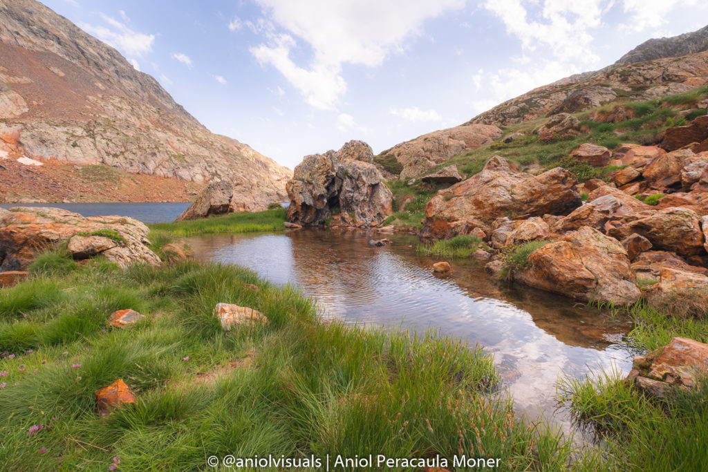
Can I swim in the lake d’Estats?
On your way up to la Pica d’Estats, there are at least two lakes, Estany de Sotllo and Estany d’Estats. Swimming in any of those, like in any other high mountain lake in the Pyrenees is prohibited.
Can I drink the water I find?
Drink the water under your own responsibility. While I am used to drinking water from the mountains, it is not a very recommended practice. Consider getting a filter for the water, as it might save you from bowel problems.
Will I have phone service?
No. Once you leave Àreu, you will not get any type of connection with the outer world until you are back. Be careful, during the hike up, my phone automatically detected the Andorran government service. As it is not part of the European Union, the prices for calling or using the internet in Andorra are very high, avoid it.
The emergency number for Catalunya is 112.
The route
Whenever I go to the mountains, my best friend is Wikiloc. For this hike, the free version is not enough, as you won’t have any service for the whole route. Paying for it is recommended and not very expensive. However, the route is very well signaled. There are plenty of red & white marks that make the route very easy to follow. This is the Wikiloc track that I followed.
Day 1: La Molinassa Parking to Estany (lake) d’Estats (3-4h)
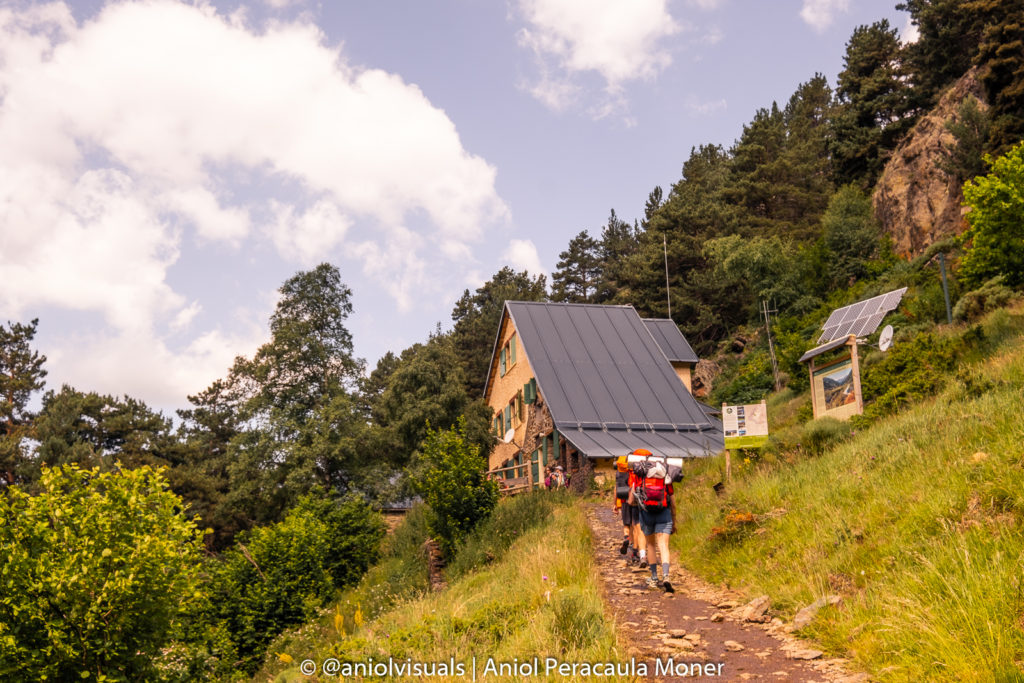
The beginning: Refugi Vall-Farrera
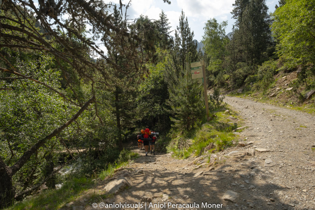
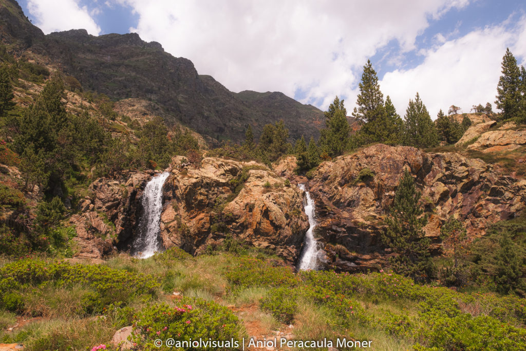
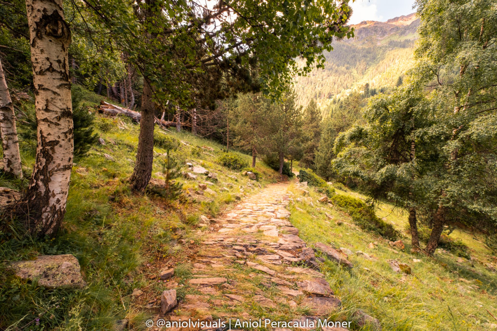
The first day consists of a beautiful hike that could be taken as a one-day hike. The route starts from la Molinassa Parking and it quickly deviates from the forest road. After a short time walking and crossing a beautiful waterfall, the Vall-Ferrera refuge welcomes us.
Being so at the beginning of the route I do not recommend sleeping there, as it is virtually the same as starting from the Parking. The only reason why anyone would sleep at Vall-Ferrera refuge is if they did walk from Àreu instead of driving or taking a taxi.
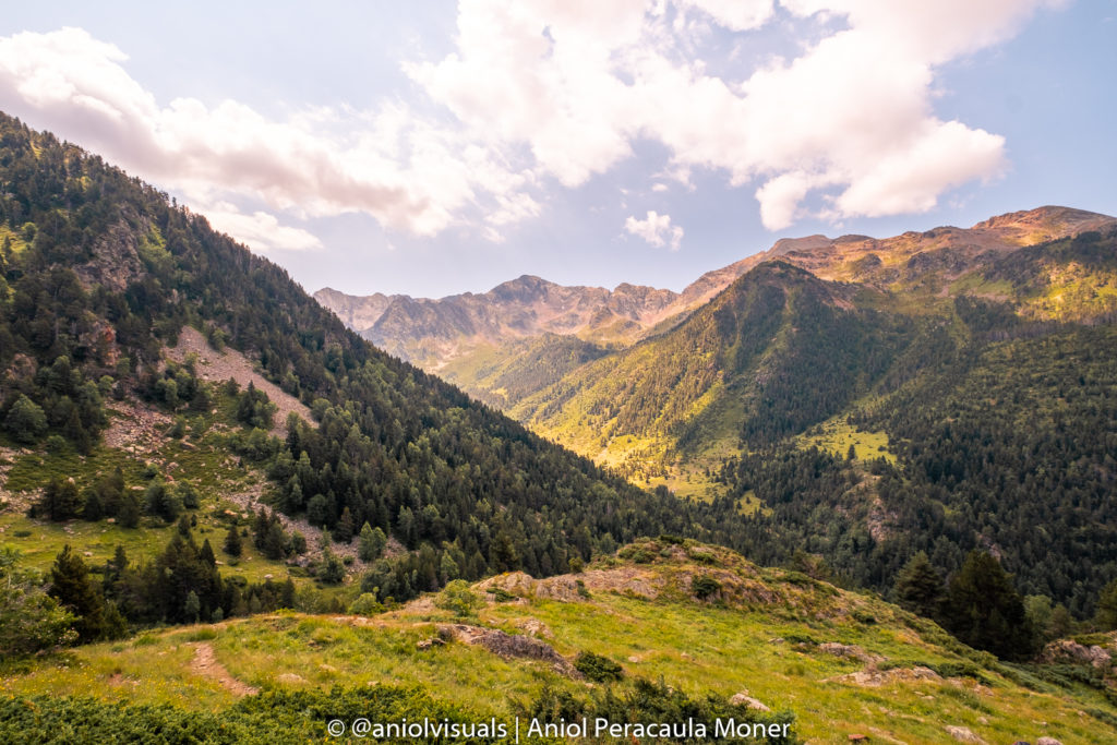
All the way up
From there, we gain elevation consistently. Get used to it, as it is how the whole route is. Follow the red and white marks, or the Pica d’Estats signs that you will eventually find. Admire the set of waterfalls that decorate the valley.
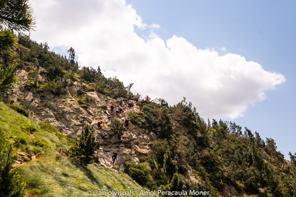
Fancy some climbing?
The only technical point of the hike is nearby. A descent through a rocky wall requires using an iron chain. It is more difficult to descent than to ascend. If you are not into climbing, there is an alternative and longer route that avoids this tricky situation.
Sotllo plain and lake
Once the chains are left behind, it is all about walking. You will cross the river for the first time and eventually find yourself in el pla de Sotllo, a humid area with a well-defined wooden path.
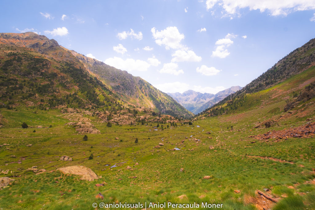
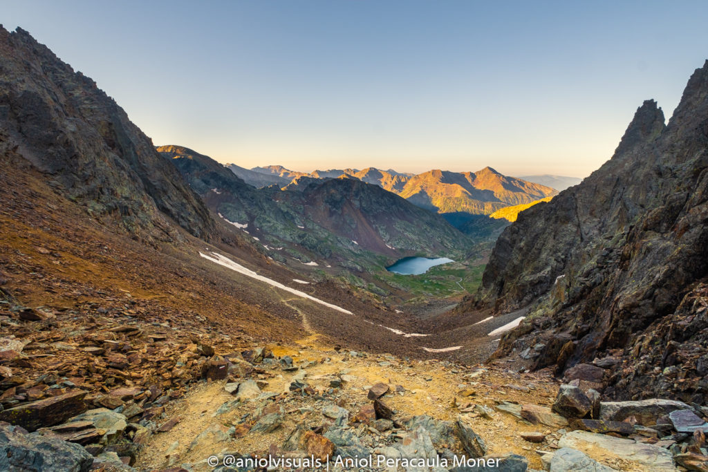
After crossing Sotllo plain, the route gets wilder, with some amazing views over the valley. After a quite steep area, you will make it to the first lake, Estany de Sotllo. Some people choose to sleep at this lake, as it can be quieter and less crowded. However, I recommend keeping walking until you reach the second lake.
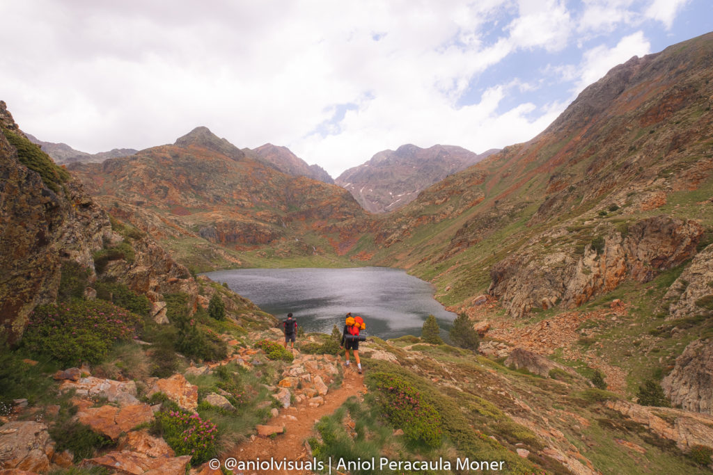
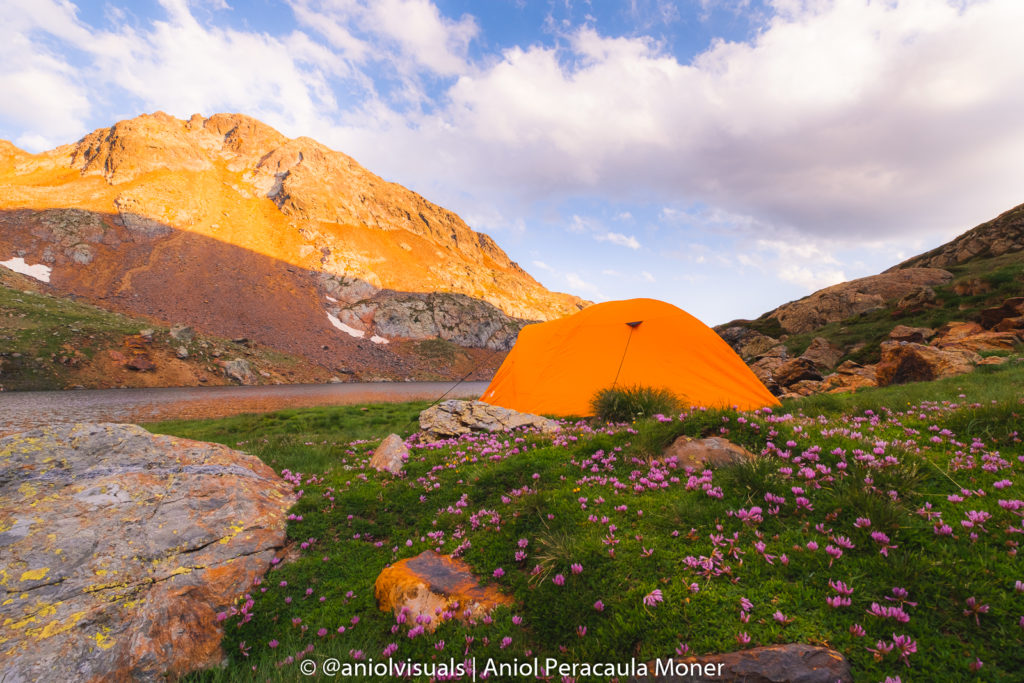
Estany d’Estats, the camping site
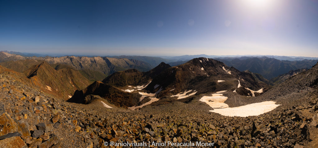
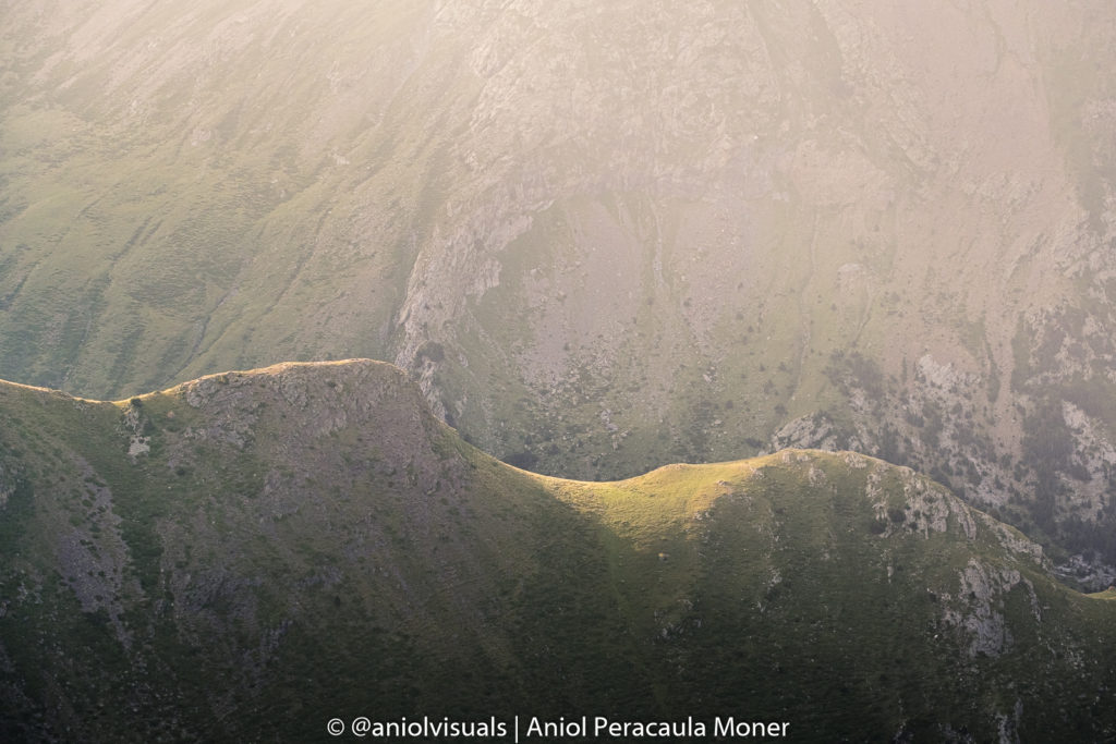
Once the Sotllo Lake is behind you it is time to tackle the last steep meters of the day, arriving at Estany d’Estats. Although you might be tired, don’t stop walking immediately once you see the lake. Keep walking and reach the farthest side of the lake, where the best areas for camping are. As you will see, more people will have had the same idea. Thus, starting the first-day hike early is recommended, arriving at Estany d’Estats around 2-3 pm should be enough to secure a good camping spot. From there you will see the steep slope that awaits, and the two highest mountains of Catalonia, la Pica d’Estats and Pic Verdaguer, one next to the other, just by the slope.
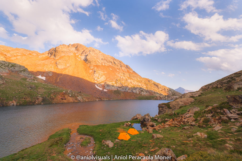
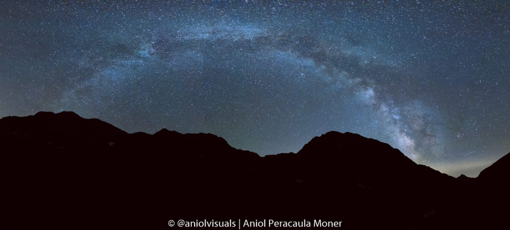
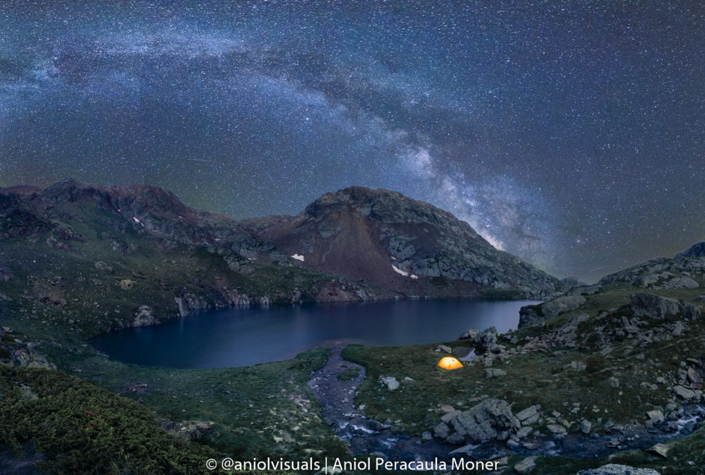
Enjoy the afternoon by the lake, sunset in the middle of nowhere, and if you are like me, the night with one of the best skies in the Catalan Pyrenees to see the stars. As a photographer, it was a perfect occasion to get a unique image of Estany d’Estats with the Milky Way behind it.
Day 2: Estany (lake) d’Estats to Pica d’Estats – Pica d’Estats to la Molinassa Parking
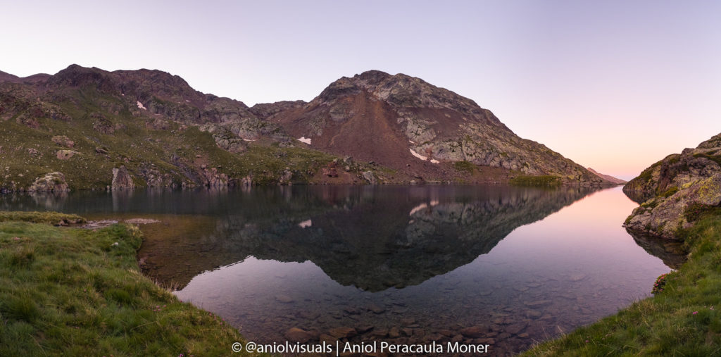
Getting up early is essential for this day, as this is the day you will climb la Pica d’Estats. We started hiking around 6.30 am, and it was perfect. Almost no people, very nice weather, and the experience of seeing the sunrise between the mountains. If you don’t want to carry a lot of weight, leave part of your stuff hidden behind some rocks. Although it is not 100% secure, robberies are not very common in this area.
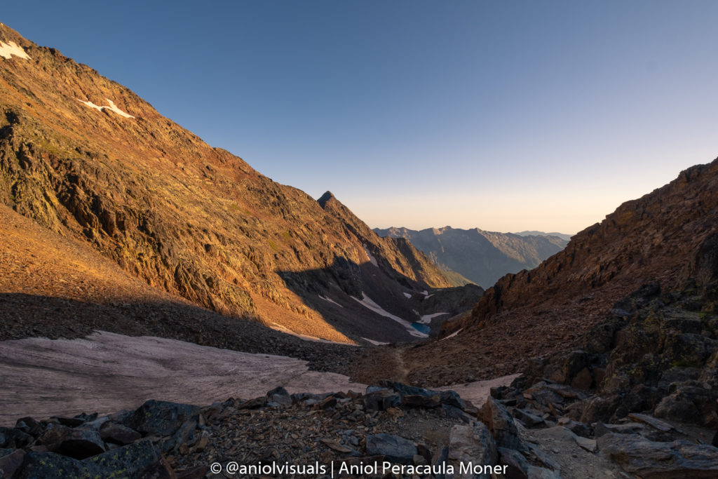
The slope to the col
Head to the steep slope, and slowly start climbing it. In the event of finding snow, make sure to check whether if you need the crampons or not to cross it. After a long and excruciating kilometer, you will reach the col or gap.
The last effort to la Pica d’Estats
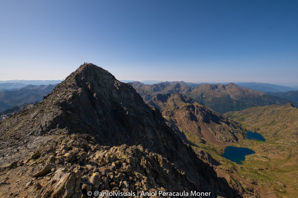
From there, there are two options: the safe & long or the crazy and fast one. The fast one is to follow the ridge to the peak of the mountain. In my opinion, it is not worth taking the risky one. The safe one implies to descend a bit and turn to the right, following the red and white signs (or yellow ones), to the peak. It takes 2-3h to reach la Pica d’Estats from the lake, and around 90 minutes from the col.
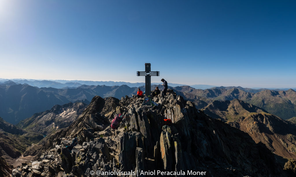
Once at the top of the mountain, celebrate and enjoy one of the best views of the Pyrenees. You did it! You are at the highest point of Catalunya!
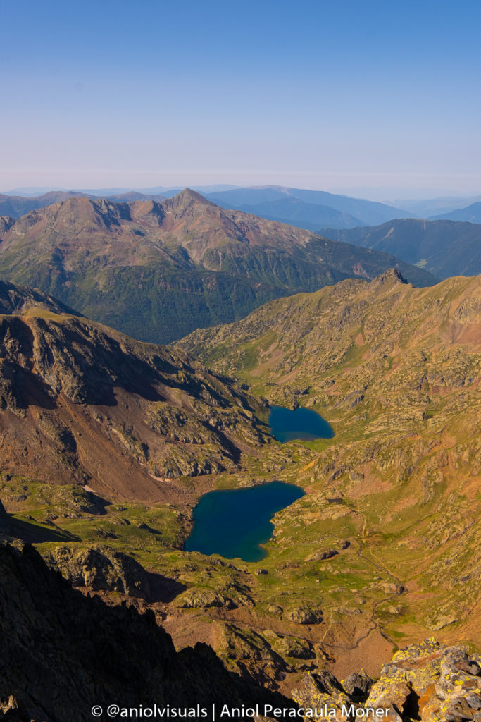
Explore Pic Verdaguer
From there, it takes less than 10 minutes to climb to the top of Pic Verdaguer, the second-highest peak of Catalunya. It is named after Jacint Verdaguer, one of the most famous Catalan poets of all time. In fact, I think views from Pic Verdaguer are way better than those from la Pica d’Estats. Moreover, it is possible to see the Pica d’Estats with the lakes below.
Descent to la Molinassa Parking
The descent is fairly easy, just exhausting. Take the same route to the col, and from there, descend to the Estany d’Estats. Grab your hidden materials, drink some water, have lunch, and walk all the way back to the parking.
This was my experience to climb la Pica d’Estats. It was an easy ascension and a hard descend, at least for me. I am used to hiking, alone and with others, and it was not my first time hiking above 3000 meters. As I mentioned previously, assess your medical condition, make sure you know where you are going, and enjoy the experience. If you have any questions feel free to leave a comment below or get in touch with me through Instagram (@aniolvisuals). For other inquiries send an email at hello@aniolvisuals.com.
Find below inspiration for other beautiful activities to do in Catalonia!

Best things to do during Girona festivities (Fires Sant Narcís)
Girona Temps de Flors: a complete guide with local tips
Best hikes in la Vall de Núria: from beginner to expert
Best outdoor day trips from Girona [with local tips]
Palamós to Platja d’Aro hike: the best Costa Brava coves
How to climb la Pica d’Estats: hiking the Catalan Pyrenees
What to do and see in Sant Pere de Rodes