Find out how to hike to one of the most beautiful lakes (Ibones de Anayet) in the Central Pyrenees! Discover when is the best season to climb it, the route, gear, and much more.
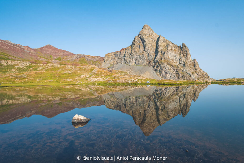
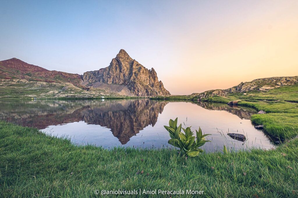
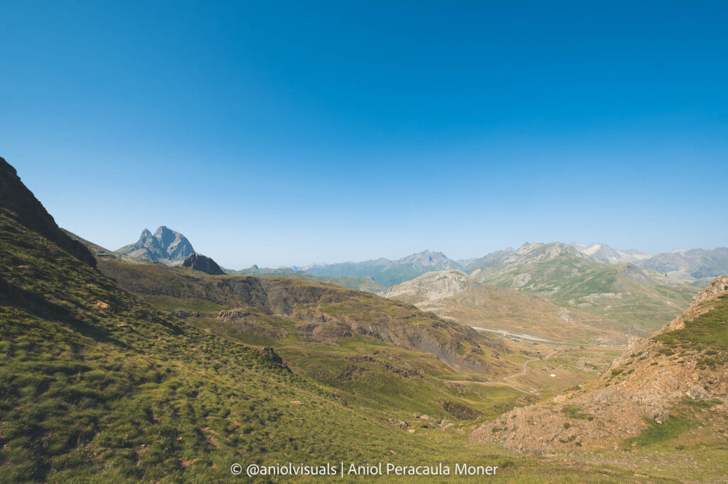
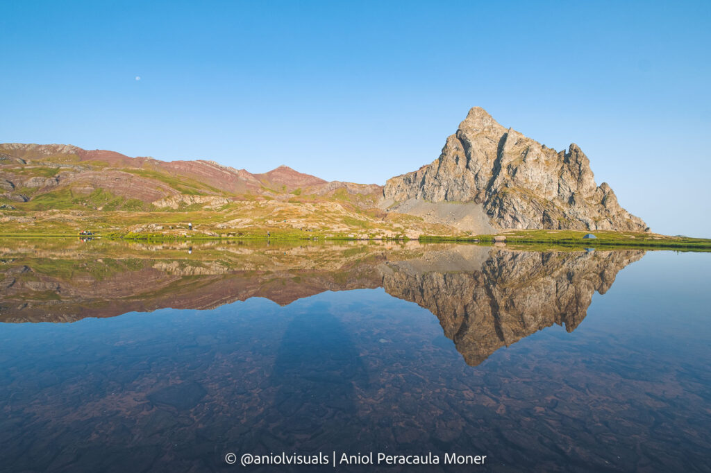
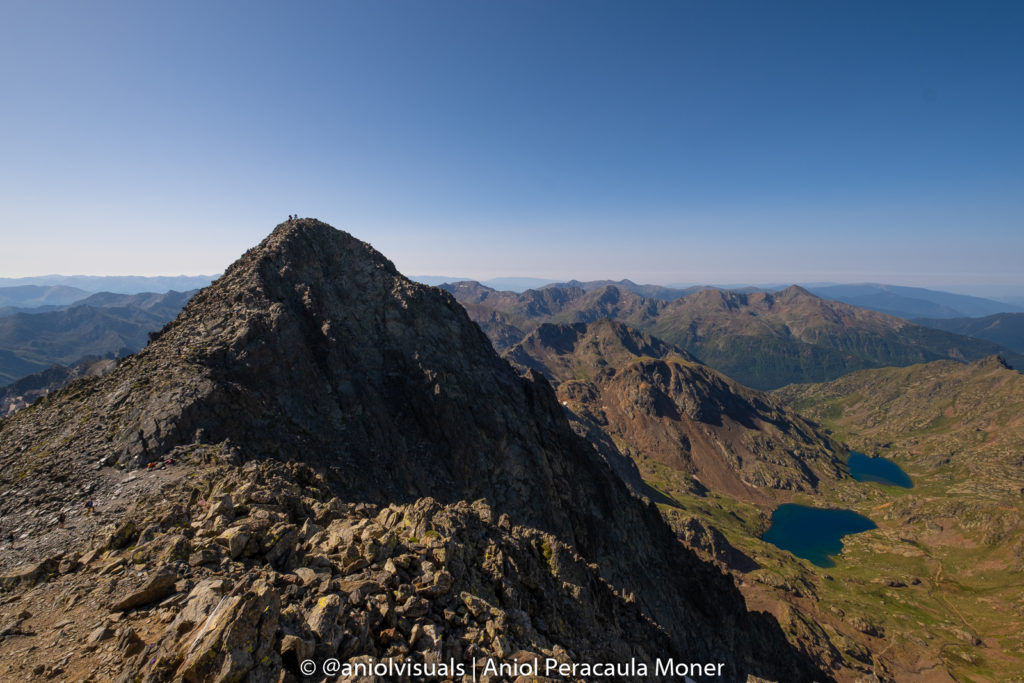
Ibones de Anayet is one of the most popular and beautiful hikes in the Central Pyrenees (Spanish side). Its characteristic peak, the beauty of the lakes surrounding it, and the nearby iconic mountains, such as the Midi d’Ossau, make it a must-hike for anyone visiting the Aragonese Pyrenees.
Located at a perfect height of 2.233 meters, and pretty accessible, it is common to find lots of hikers on summer weekends. Moreover, anyone with a good physical condition can complete this hike, and the view of the lakes is worth every single step.
- Ibones de Anayet FAQs
- What does Ibones mean?
- When is the best season to hike Ibones de Anayet?
- What is the hike starting point?
- How long does it take to climb Ibones de Anayet?
- What to pack for Anayet?
- Can I camp wherever I want in the Central Pyrenees?
- Can I swim in the Anayet Ibones?
- Can I drink the water I find on the way?
- Will I have phone service?
- Can I bring my drone to Ibones de Anayet?
- The route
If you are reading this it is likely that you are considering climbing Ibones de Anayet. Congrats! It is a really good choice, and I hope you find useful information here. Otherwise, feel free to leave a comment with your questions below or get in touch with me through Instagram (@aniolvisuals).
Before talking about the exact route, and getting more technical, let’s tackle some of the most important FAQs related to climbing Ibones de Anayet.
Ibones de Anayet FAQs
What does Ibones mean?
Let’s start with the basics. The first time I saw a photo of Ibones de Anayet, I was a bit confused. Anayet is the name of the Peak in front of the lakes, but what does Ibones stand for? To make it easy, Ibon means Lake. It is a Spanish word (and a Basque name) that especially in the Aragon Pyrenees you will find everywhere. However, if you move to the Catalan Pyrenees, you will hear much more of the word Llac, Catalan for Lake. And if you go to the French side, they will use Lac.
Thus, Ibones de Anayet could be translated into Anayet Lakes.
When is the best season to hike Ibones de Anayet?
The good news is that it is possible to climb Ibones de Anayet almost 365 days a year. However, your experience will change depending on the season.
First of all, the way up to the lakes crosses a ski slope. Thus, during winter, it will be a bit more complex due to the popularity of the Formigal and Anayet slopes.
Its height (2.233 meters) and strategic location at the heart of the Pyrenees, means that you can expect some snow up there almost from November until May. I have been twice to Ibones de Anayet: once in July (no snow) and once in late May (snow at the lakes).
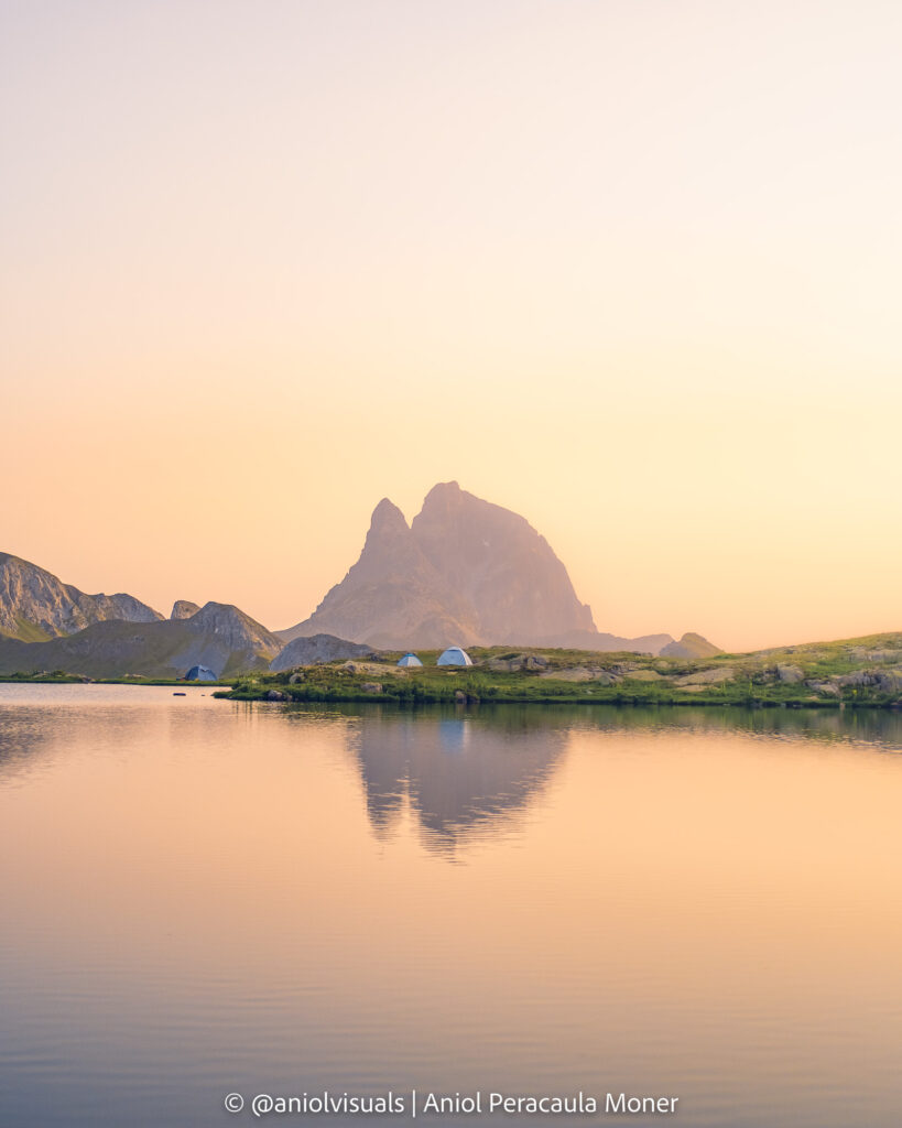
Thus, when is the best season to climb Ibones de Anayet? If you don’t bring your skis, Summer and early Autumn are the best bet. Moreover, it is when you will have the optimal temperatures to divide the hike into 2 days and spend the night by the lake (see below).
What is the hike starting point?
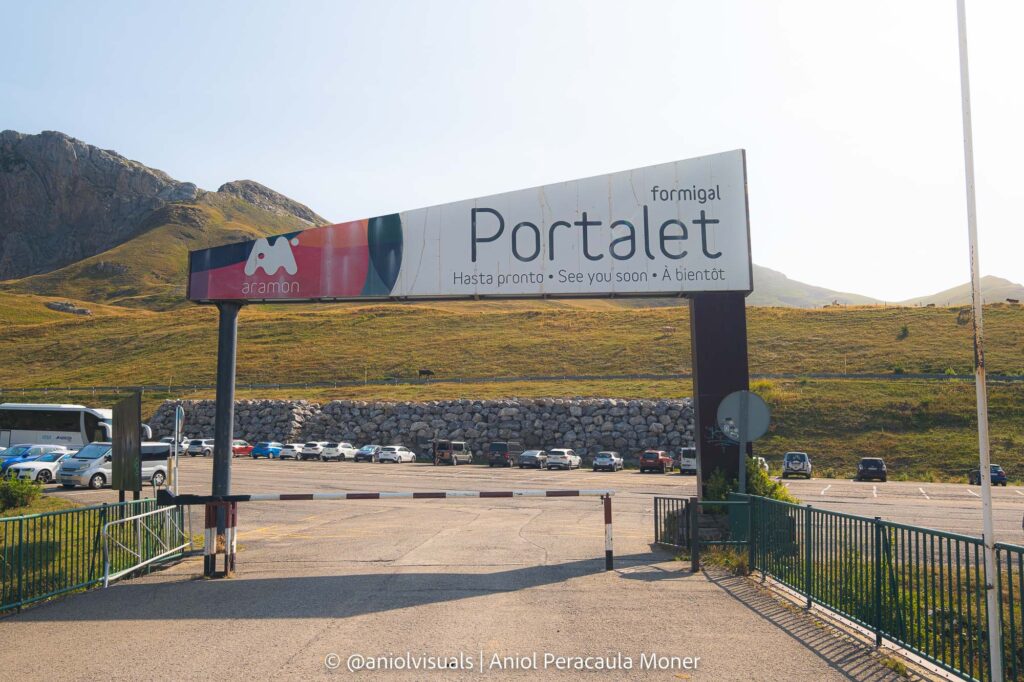
There are two main points from where the Ibones de Anayet hike can be started: Corral de las Mulas parking and Portalet ski station.
They are quite close to each other (a 3-minute car drive), but the route changes a bit. I have hiked both routes, and they are quite similar in distances and elevation gain (a bit more elevation gain from Corral de las Mulas). However, starting from Corral de las Mulas will guide you all the way to the Anayet Ski station and then into a valley that ends with a steep hike all the way up to the Anayet lakes. Instead, if you start from Portalet ski station you can see a couple of more Ibones (lakes).
Although I like the Portalet Route more, because I love lakes, both of them are worth it. During the peak of the hiking season, though, it is more difficult to find a spot for your car at the Corral de las Mulas Parking, which is ridiculously small. The Portalet ski station, instead, has a large parking lot that will rarely be full during the summer months.
How long does it take to climb Ibones de Anayet?
Unlike other Pyrenees hikes (like pica d’Estats, the highest peak in Catalan Pyrenees), Anayet is an easy one. Well, easy for anyone in an acceptable physical condition. It has almost zero technical difficulties, only some steep but safe segments. The route is very well signaled, no matter what is your starting point.
Looking for a greater challenge? Climb la Pica d’Estats!
Discover the highest peak of the Catalan Pyrenees, and how to get to its top, over 3.000 meters! Check the guide here!
If you are a quite agile and fast hiker, it will take you less than 2 hours to get to the lakes, and 1h30′ to go back (from both starting points). Nonetheless, there is an almost 600 meters elevation which slows down some people. Moreover, there are some hikers that decide to climb the Anayet peak after visiting the lakes. It adds an extra 250 meters of elevation and some technical and aerial areas to the route.
Going from Portalet Ski station to Anayet and back is 11.5 kilometers while starting from Corral de las Mulas is 12.6 kilometers. There are many variations to these routes. The ones I will be sharing below will be circular to explore different areas of the valley and see more lakes and views.
What to pack for Anayet?
The answer to this question will depend on one simple thing: will you spend a night up in the lake? If the answer to this question is no, then your packing list will be fairly shorter.
Instead, if you want to spend a night by the lake (highly recommended), you should bring gear to sleep (which changes depending on the season). I have done both routes, the one-day and the two-day hike, and although I carried a tent, did bivouac.
This is what I recommend for a 1-day hike to Anayet Ibones during summer:
- Water bottle
- Emergency kit
- Smartphone
- Hiking boots
- Trekking poles (optional)
- Sunscreen
- Hat
- Food
- Mosquito repellent
If you plan to spend the night up in the lakes, then add the following items to the list:
- Tent (optional, I did bivouac but carried it, weather changes quite fast in the Pyrenees)
- Sleeping bag
- External battery
- Jacket (it gets cold and maybe windy, even during the summer months)
- Extra socks
- Clothes
- Head torch
Can I camp wherever I want in the Central Pyrenees?
Spain is one of the worst places to free camp in the world. The easy answer is that you can’t camp at the Pyrenees. But this is the short one. Truth is, it depends on the area. In the case of Anayet, it is located in the Aragon Autonomous Community, and its rules apply. Given that it is not a natural park, there are no specific caveats.
The law says that if you want to camp above 1500 meters in the Aragon Pyrenees, within a 2h walking distance of any accessible location, you need to notify the Autonomous Community. Moreover, the tent can’t be up during the whole day, only at night time.
Truth is, I doubt 90% of the people that sleep there do it. I did it, completed the official form (here, website in Spanish), and sent it to the Canfranc Tourism office. I will leave it to you to decide what to do. Nonetheless, no matter what you do, respect the environment. If when you leave no one can tell you were there, this is a good sign.
Can I swim in the Anayet Ibones?
Unlike other areas in the Pyrenees, it is not forbidden to swim in Anayet Ibones. Nonetheless, there are good reasons not to do it. The first one is the negative impact of people swimming in the Ibon on the water and the environment. Sunscreen, mosquito repellent, makeup… have a massive impact on the ecosystem. The second one is that the Ibon is infested with leeches.
Can I drink the water I find on the way?
I would not recommend drinking most of the water you can find on the route. There are cows and other animals that roam around the water, and unless you have a way to purify the water, bring your own bottle and stay safe. It also depends on how used you are to drinking water from high-mountain sources.
Will I have phone service?
Yes, during 90% of the route there is service. Once at the lakes, there are areas without any coverage and others with even 5G. Nonetheless, it will depend greatly on who you have as a phone provider, as I know people who had almost zero phone service during most of the route.
Also, your phone might recognize French coverage instead of Spanish at some point, due to being quite close to the border. Be aware of that, some companies charge you extra when changing between countries.
The emergency number for Aragon is 112.
Can I bring my drone to Ibones de Anayet?
Many people bring their small flying friends up in the mountains to get even more amazing photos and videos. As of July 2022, it is legal to fly a drone in Anayet without requesting any permission. Nonetheless, you have to comply with the Spanish and European legislation.
To check if whenever you are reading this it is possible to fly your drone, at Ibones de Anayet, find the official Spanish map for fly/no-fly and restricted drone zones here.
The route
There are two routes to get to Anayet, depending on where you start hiking from, with multiple variations. For any of them, you can find plenty of tracks online on Wikiloc. Here, though, I have will list two circular options, one starting from Corral de las Mulas, and my favorite one, starting from Panticosa Ski Station.
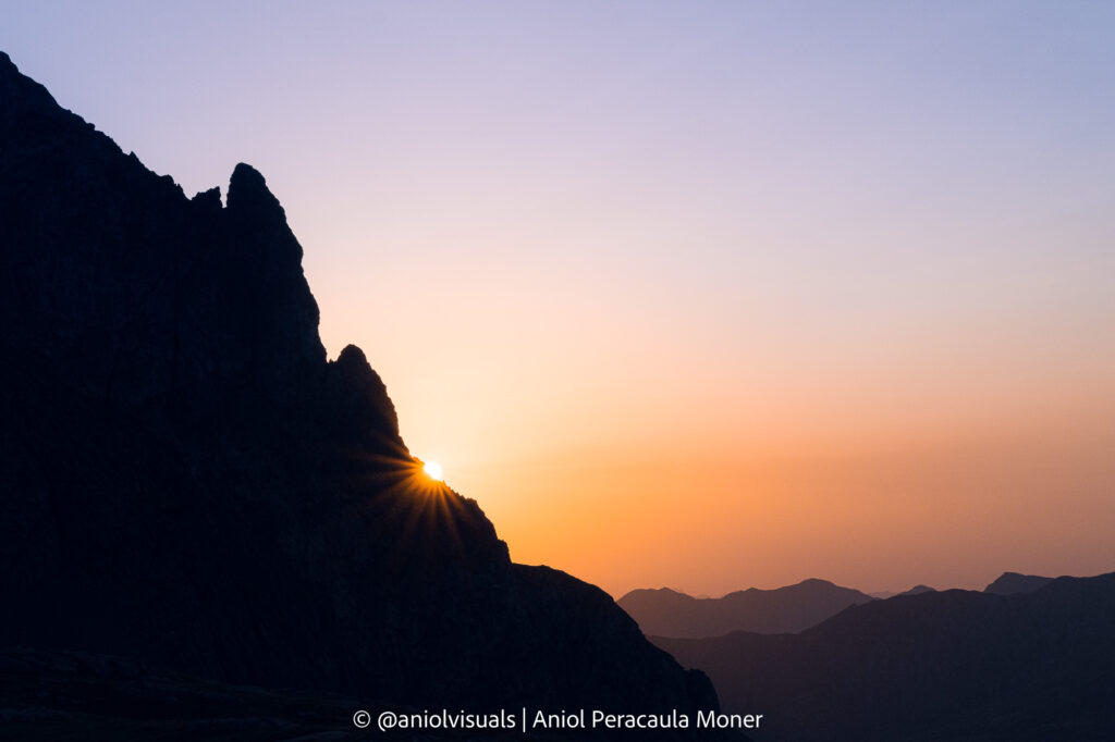
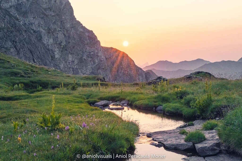
Both hikes can be done in one day (even half, if you are an avid hiker), or split into 2 parts, to enjoy the fantastic views of the sunset behind the Anayet peak and lakes, and the beautiful starry sky that comes after. If you choose to hike Ibones de Anayet in 2 days, I would recommend starting hiking around 4-5 pm and do either another hike in the morning or discover the nearby villages of Sallent, Panticosa, or Formigal.
Option 1: Ibones de Anayet hike from Portalet Ski Station
Start: Portalet Ski station
The starting point of the hike is Portalet Ski station. Its large parking lot and proximity to the Portalet (Spain-France border) make it a strategic place, thus, the large number of parking spots. Once there, cross the river and go to the end of the ski slopes. Once there, start hiking up. Almost all the way to the Ibones is up, with few flat areas, so make sure not to go too fast. You might see some people going to the left, hiking a ski slope. Don’t do it, it will be your way down. Instead, take the road on the right, and follow it.
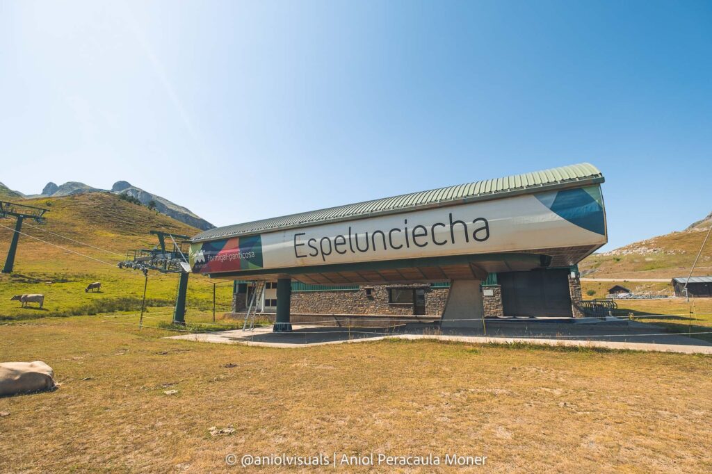
Up to Espelunciecha Ibon
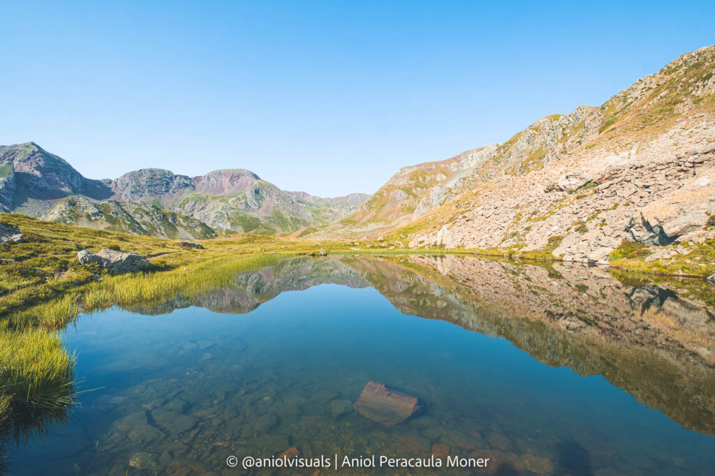
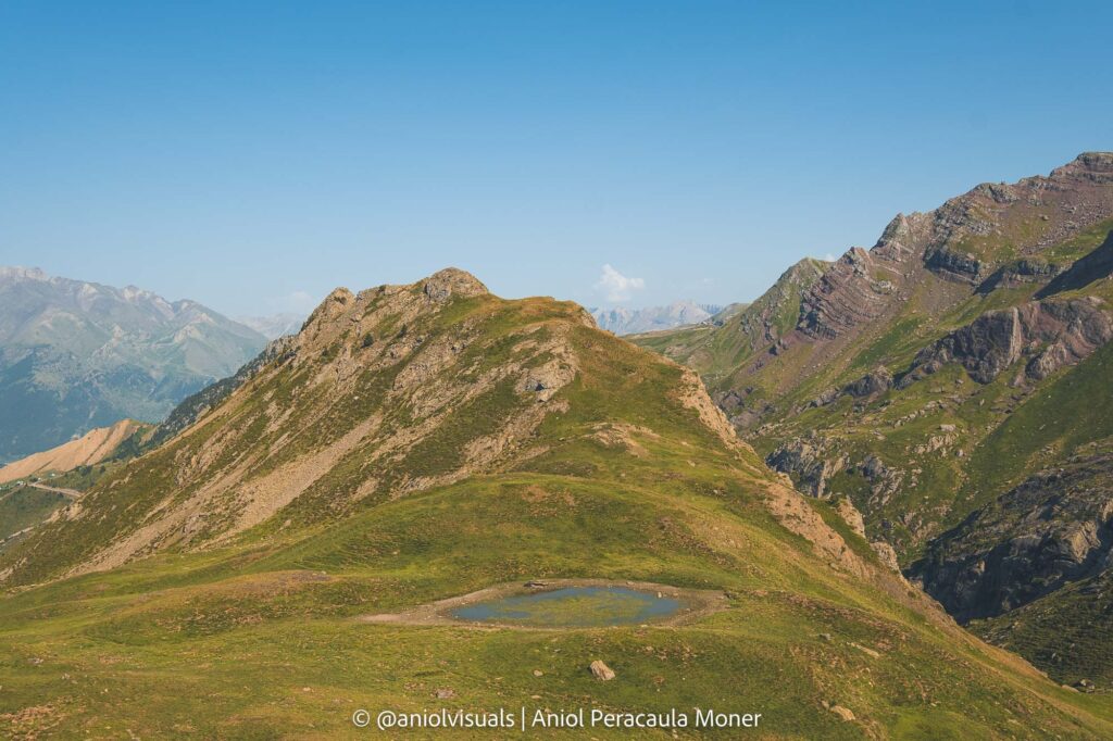
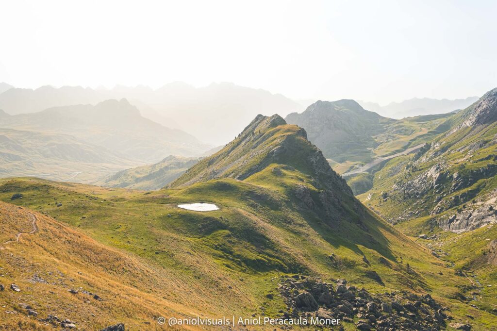
After a mix of roads and some sections of beautiful fields, you will make it to Espelunciecha Ibon. This medium-size lake is sometimes forgotten because of the proximity of Ibones de Anayet. Nonetheless, it is located in a fantastic spot and is a great place to take a couple of photos. From the Ibon, go back to the main road, and keep climbing, until the track (see above the strava track), leaves the road.
From Espelunciecha to the shared trail
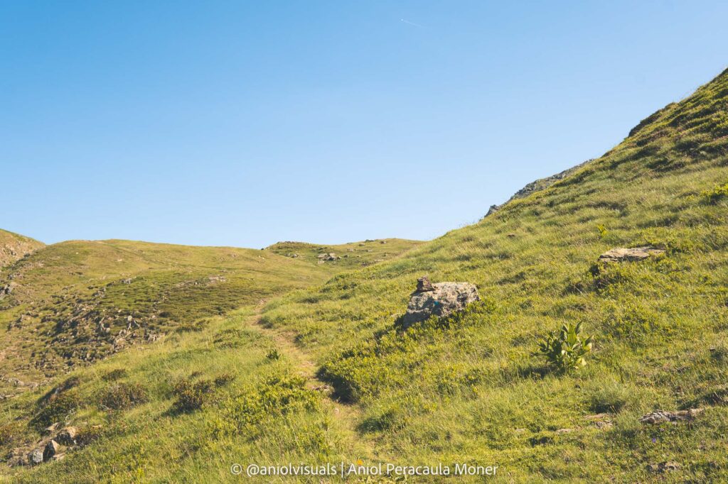
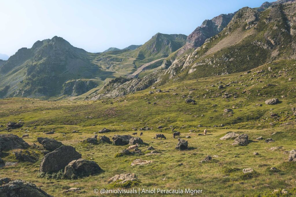
Once there, you will take a less frequented path, that will lead you to some fantastic and quiet fields, with great chances of seeing marmots or other wildlife. After some time, you will see that the path you follow leads to the main path to Anayet, a section shared with the return of another route.
The last climb to Ibones de Anayet
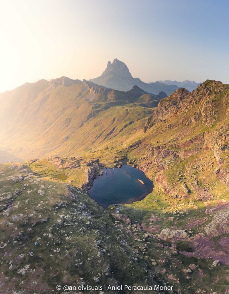
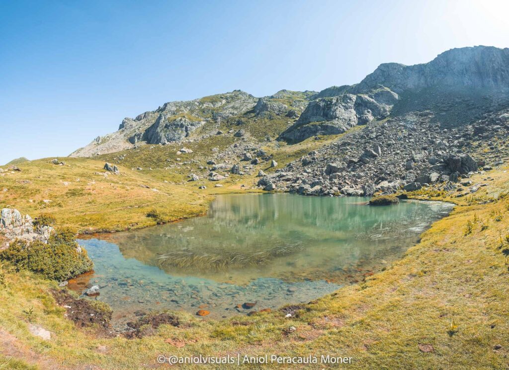
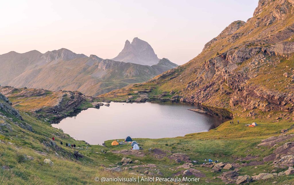
Then, it is the last climb. It is steep, but the reward is so worth it. You will see one of the best views of the valley, with a small, yet beautiful Ibon on your left, and the first glance of the Anayet peak in front of you. Take your time and enjoy the last section.
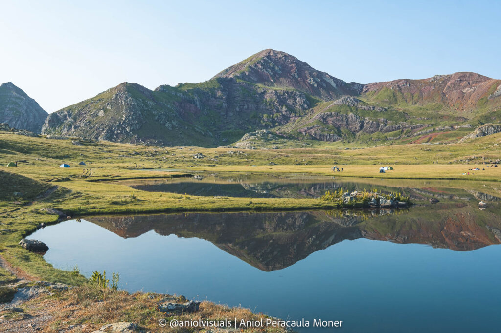
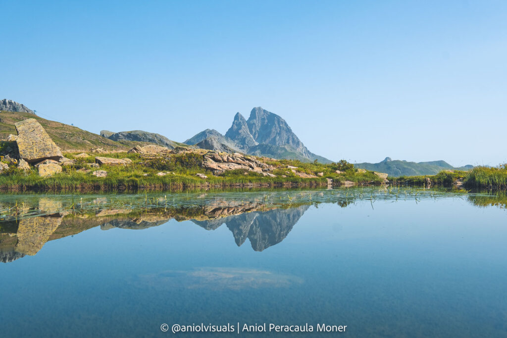
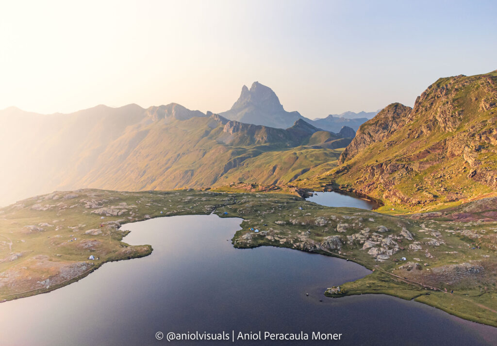
Once at the Ibones, make sure not to visit only the main one, but also its smaller brother. It has one of the best views over the Midi d’Ossau, a quite famous mountain on the French side of the Central Pyrenees.
Follow the main trail until la Glera
It is time to return. Either if you have spent the night by the lake or just had a quick snack, keep your camera close. The main trail that you followed on the way up is your friend. Start descending, until you see a small wooden hut. This is la Glera, a bar/restaurant during the ski season, that is usually closed during summer. A few hundred meters before arriving at la Glera, there is a path to the left. Take it.
The small Ibon
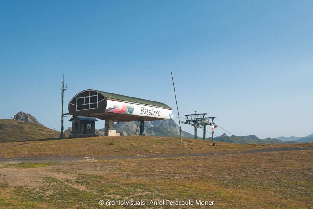
Follow this ascending path until you reach a small, yet beautiful Ibon. From this lake, there is a really nice view over the valley, although you can’t see the Portalet Ski station yet. Now, follow the track until you reach the end of the Batallero chair lifts.
End: Ski slopes to Portalet Ski station
This is the ugliest part of the hike, following the ski slope all the way to the parking. Nonetheless, there is the last surprise. On the left-hand side, you will see a small lake, much less impressive than the others you have seen during the hike. Nonetheless, this lake is perfect to take a unique photo: the Midi d’Ossau reflected on its waters. It remains one of my favorite photos of the hike.
Option 2: Ibones de Anayet hike from Corral de las Mulas
Start: Corral de las Mulas
Corral de las Mulas is a small parking lot at the side of the road on the way to Portalet. It does not hold more than 20 cars, and it is usually full of vans. This is one of the reasons why I recommend the other route. Nonetheless, if you wake up early, you should be okay. Otherwise, there are some nearby areas where people park their cars, and then walk 2-3 minutes to the hike starting point.
Up to the Anayet Ski Station
The first section of the hike is very simple: follow the road that connects the Corral de las Mulas with Anayet Ski station. If you are visiting during winter, this part of the hike might not be necessary, as it is open and accessible to anyone. During the hiking season, though, it is not possible to reach the large parking lot of Anayet Ski station.
Barranco de Culivillas
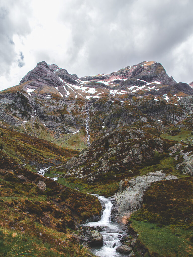
Once at the Anayet Ski station, the adventure starts. Take a path (very well signaled) on the right-hand side, and you will start to climb and follow a small river. This stream of water comes directly from Anayet. The easy indication is to follow it until you reach the Lakes. All this section of the hike is the Barranco de Culivillas and has some fantastic views of the surrounding mountains.
Steep hike until Ibones de Anayet
At some point, you will see a quite steep section in front of you, and maybe a huge waterfall (depends on the conditions, and season…). This is the last section of the hike. Hike all the way up to the Anayet Ibones. Before reaching them, though, notice the path that does not go down to Barranco de Culivillas, but instead follows the mountainside, and admire the impressive view.
From the Ibones to la Glera
After either spending the night or just some time at the Ibones, it is time to go back. If you have read hike option 1, this will sound really familiar, as you have to take the same exact path to the small wooden hut of la Glera. Admire the aerial view of a small lake on the right-hand side, one that you couldn’t see on the way up.
La Glera to Anayet Ski station
Instead of not getting to la Glera, like in option 1, you should walk just by the side of the small winter bar/restaurant. Once there, follow the path that descends slightly to the right. You can already see the Corral de las Mulas Parking and Anayet Ski station, your last stop.
End: from Anayet Ski station to Corral de las Mulas
At the Anayet Ski station, the path you follow meets with the one you took on the way up. Now it is just a matter of time to walk down from the Ski station to the Corral de las Mulas parking, where your car will be waiting for you.
These are two options for how to hike Ibones de Anayet. Both are amazing hikes, with impressive views, and 100% worth it. Despite the 600mts elevation gain, the hike is not technical, and almost everyone can complete it. Make it unforgettable by spending a night by the lakes.
If you want to discover more Pyrenees hikes, make sure to check the suggested articles below. Got any questions regarding the hike? send me an MD on Instagram (@aniolvisuals). For any other inquiries, you can find me at hello@aniolvisuals.com.

Best things to do during Girona festivities (Fires Sant Narcís)
Girona Temps de Flors: a complete guide with local tips
Best hikes in la Vall de Núria: from beginner to expert
Best outdoor day trips from Girona [with local tips]
Palamós to Platja d’Aro hike: the best Costa Brava coves
How to climb la Pica d’Estats: hiking the Catalan Pyrenees
What to do and see in Sant Pere de Rodes